


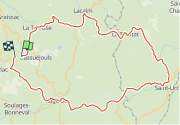
Ronde cassejouls lacalm piste de ski

bidetarou
User

Length
54 km

Max alt
1297 m

Uphill gradient
860 m
Km-Effort
66 km

Min alt
846 m

Downhill gradient
877 m
Boucle
No
Creation date :
2021-06-26 13:02:38.785
Updated on :
2021-06-26 16:29:55.702
3h26
Difficulty : Difficult

FREE GPS app for hiking
 SityTrail
IGN / Geographical institutes
SityTrail Plus
The world is yours!
About
Trail Bicycle tourism of 54 km to be discovered at Occitania, Aveyron, Argences en Aubrac. This trail is proposed by bidetarou.
Positioning
Country:
France
Region :
Occitania
Department/Province :
Aveyron
Municipality :
Argences en Aubrac
Location:
Unknown
Start:(Dec)
Start:(UTM)
483950 ; 4952631 (31T) N.
Comments